
Indian Trail ZIP Code Directory Coverage
This Indian Trail ZIP code directory separates verified postal evidence from nearby label possibilities. USPS confirms 28079 as the primary Indian Trail postal ZIP through its local post-office record. Union County material also shows that addresses in and near Indian Trail can carry 28104 or 28110 in an official context. Those examples show postal variation, not a map of corporate limits. No authoritative USPS file was located that draws every Indian Trail municipal ZIP boundary.
| ZIP | Areas Covered | Post Office | Notes |
|---|---|---|---|
| 28079 | Indian Trail postal context and Indian Trail Lake Park grouping | Indian Trail Post Office serving Indian Trail | Verified Indian Trail primary postal ZIP; check the Indian Trail exact address and town limit |
| 28104 | Matthews, Stallings, Weddington, Wesley Chapel, and Indian Trail-area context | Indian Trail postal-label possibility | May occur in Indian Trail portions or nearby communities; it does not prove Indian Trail town limits |
| 28110 | Monroe, Unionville, and an Indian Trail official-address context | Indian Trail label variation | Indian Trail address context exists; verify the Indian Trail parcel and municipality |
| 28111 and 28112 | Nearby Monroe postal geography, not an Indian Trail assignment | Indian Trail verification required | Not verified as current corporate Indian Trail service ZIPs |
| 28105, 28108, 28227, 28270 | Unverified for corporate Indian Trail | Indian Trail classification withheld | Use USPS and an Indian Trail county boundary check before assigning any of these ZIPs |
A ZIP alone never proves municipal limits, a recorded owner, a current resident, or a town service area. Those are separate questions held by different offices. The table therefore favors an exact-address check over a broad ZIP list.
Indian Trail ZIP Code 28079
ZIP code 28079 is the clearest primary postal association for Indian Trail. The Indian Trail Post Office is listed at 210 Postage Way, Indian Trail, NC 28079-9701. That identifies a USPS location and its postal ZIP. It does not turn 28079 into a legal outline of the Town of Indian Trail. A specific address can still require a parcel and municipal-boundary check, especially near a town edge or where a mailing label differs from the municipality.
The USPS location record identifies the Indian Trail post office tied to 28079.
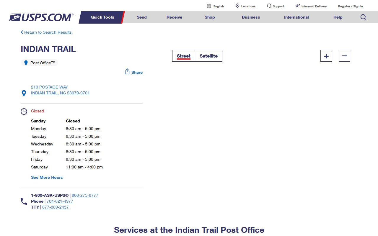
The location is strong evidence for the primary postal association, while the full address remains the unit that USPS can verify for delivery.
Indian Trail ZIP Code Label Changes
Postal processing and mailing labels can move without changing a town boundary. USPS bulletin material records changes involving ZIP 28079, and the North Carolina label list includes 28079, 28104, 28110, 28111, and 28112 among nearby Matthews or Monroe label contexts. That history explains why an Indian Trail-area address may not read exactly like the town name a person expects. It does not establish that every address with one of those labels is inside, or outside, Indian Trail.
The 2023 USPS Postal Bulletin supplies the official label-change context used for this ZIP code directory.
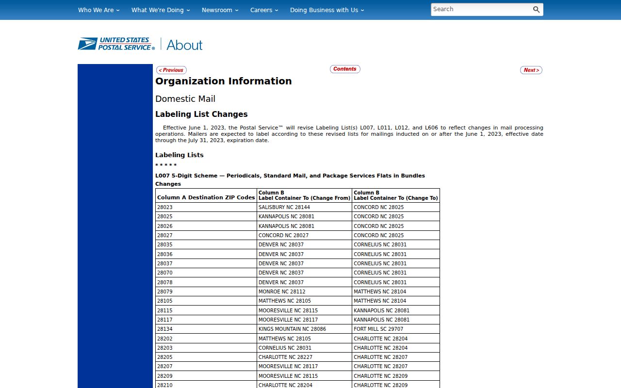
Read a processing or label change as postal administration, then verify the location through the address and county tools.
Note: A postal city, a sorting label, and an incorporated municipality can legitimately use different names for the same broad area.
Check an Indian Trail ZIP Code
The official sequence starts at the address level. Use the USPS ZIP Code Lookup for the full street address. Next, use the Union County Property Tax Inquiry or UC Atlas to inspect the parcel and address context. Then run Determine Your Municipality by street address or parcel ID. Keep mailing ZIP, postal city or label, county, and incorporated municipality in separate notes.
- Enter the complete mailing address in the USPS exact-address tool.
- Record the returned ZIP and postal city exactly as USPS gives them.
- Find the address or parcel in Union County Property Tax Inquiry or UC Atlas.
- Check the street address or parcel ID in Determine Your Municipality.
- Flag any mismatch between the mailing ZIP, postal label, county record, and municipal result for human review.
| Official input | What it helps confirm |
|---|---|
| Indian Trail full street address in USPS | Indian Trail mailing ZIP and postal city for that delivery address |
| Indian Trail address or owner in Property Tax Inquiry | Indian Trail parcel-card and recorded-property context |
| Indian Trail address search in UC Atlas | Indian Trail parcel geometry and available county map layers |
| Indian Trail street address or parcel ID in Determine Your Municipality | Indian Trail county result for municipal jurisdiction |
The USPS address-lookup screen is the first, not final, step.
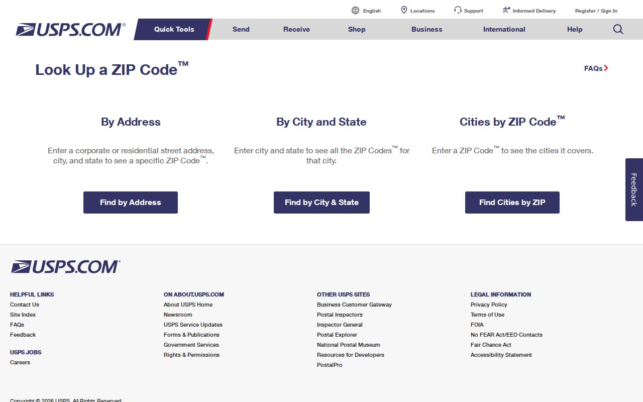
Once the exact ZIP is known, the Indian Trail By Street directory is the appropriate route for the separate street-level parcel trail.
Indian Trail ZIP Code Geography
For this ZIP code directory, the important distinction is delivery geography versus civic geography. USPS assigns ZIPs to route mail. Union County maps and parcel records organize county information. The Town of Indian Trail boundary identifies the incorporated municipality. A mailing label can overlap a practical search area without deciding which local government serves the address. This matters near annexations and along major roads, where older labels and current boundaries can diverge.
The town's 2026 Augustus Beamon Drive and Waxhaw-Indian Trail Road annexation is a local reminder that a boundary can change through an ordinance affecting part of a parcel. A postal ZIP does not automatically update the municipal conclusion. Use the current municipal check whenever a records question depends on town jurisdiction.
Indian Trail ZIP Code Terms
Postal terms can look more precise than they are. A short glossary helps keep an Indian Trail ZIP code result in its proper scope. These terms describe mailing and delivery organization; they do not identify a parcel boundary, a person, or a municipal service area.
- ZIP code
- A five-digit USPS delivery geography used to route mail.
- ZIP+4
- An added four digits that refine delivery sorting within a five-digit ZIP.
- PO box ZIP
- A ZIP used for post-office boxes, which can differ from a street-delivery ZIP.
- Unique ZIP
- A ZIP assigned to one organization or high-volume receiver, when USPS makes that assignment.
- Carrier route
- A postal delivery route used for mail handling, not a town-boundary line.
Neither a ZIP+4 nor a carrier route proves that a location sits inside Indian Trail. They refine delivery handling only. The county parcel and municipality result are the better follow-up for civic geography.
Indian Trail ZIP Code Scale
Indian Trail's address system serves a growing place, but Census figures do not identify any individual address or resident. Census QuickFacts reports a 2025 population estimate of 44,303, compared with 39,997 at the 2020 Census, a 10.3 percent change. The town's land area is reported as 22.24 square miles. Those figures explain why current parcel and address data matter more than a static ZIP assumption.
The official Indian Trail QuickFacts table provides the population and land-area context.
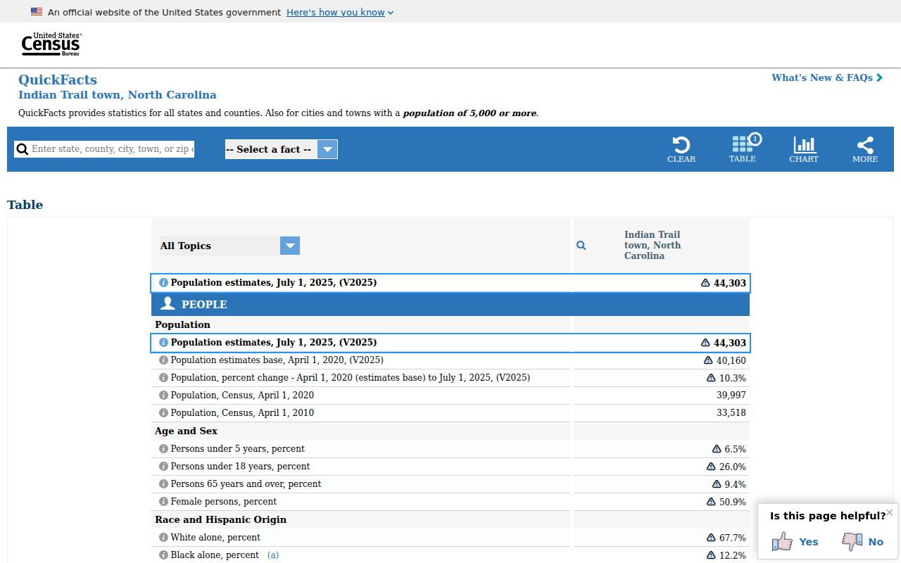
Use the town-wide figures as context only, then return to USPS and county tools for a specific address question.
Indian Trail ZIP Code Limits
ZIP code results have clear limits. They do not prove that a property is inside town limits, that a parcel's recorded owner lives there, or that a person uses the address. They also cannot settle service boundaries. When the answer depends on an existing public record, North Carolina Public Records Law, Chapter 132, allows inspection and copying subject to record-specific limits. It does not require an agency to build a new address list or a new ZIP compilation.
Where county information and USPS do not line up, retain both results and ask the relevant custodian about the discrepancy. UC Atlas updates address points daily or the next day, parcel downloads monthly, zoning in about a week, and FEMA layers on a separate schedule. A new or changed address may therefore appear in one source before another. Careful dating is part of a reliable Indian Trail ZIP code directory search.
Note: The research found no authoritative USPS corporate-limit ZIP boundary file, so unverified nearby ZIPs should stay unclassified until checked address by address.